
Walk a Charleston Street Record
A street search should move from place to person, then back to the record that proves each fact. Start with a complete Charleston address if one is known. If the exact number fails, search the street name alone and narrow the results by ZIP and tax year. Keep the parcel ID, property address, owner name, and book/page reference as separate notes. They do not all mean the same thing.
- Run the number and street through the Kanawha County assessor search. Record the parcel ID, situs address, owner, mailing address, tax year, and any book/page field.
- Open the parcel in the statewide viewer. Confirm the mapped street and note nearby parcel IDs without treating map lines as a survey.
- Search the deed index for the current owner as grantee, meaning buyer. Match the legal description before accepting a result.
- Use the lawful voter channel only to confirm a known registrant or to request authorized fields for a defined area.
- Check an available historical directory year when the question concerns an earlier household. Record the year and page because directory coverage has gaps.
This sequence keeps a Charleston street directory from turning ownership into an unsupported claim about occupancy. An owner may receive tax mail elsewhere. A voter may have moved after the latest update. A directory entry may describe a business or boarder. Agreement across dates and record types is much stronger.
Search Charleston Streets in IAS
The WV IAS Real Property Search is the main address-keyed tax search. It permits any combination of criteria and tells users to enter owners as last name then first name, without commas. The captured tax-year menu ran from 2016 through 2025. During the research inspection, the system showed a maintenance notice, so the Charleston street directory also needs the assessor office fallback at 304-357-0250.
| IAS field | Input | Use on a street | Key limit |
|---|---|---|---|
| Parcel Address # | Street number | Narrows one site | Old numbers may fail |
| Street | Street name | Builds a street result set | Spelling must match |
| ZIP Code | Postal code | Reduces false matches | Not a city boundary |
| Owner Name 1/2 | LAST NAME FIRST NAME | Checks a known owner | Not occupancy proof |
| Parcel ID | Parcel identifier | Links map and tax row | Format may be exact |
| Book / Page | Reference fields | Helps bridge to title records | Confirm in deed record |
| Tax Year | 2016–2025 captured | Dates the result | Live options can change |
The official search screen shows how Charleston property queries can be narrowed. See the IAS source used for the captured form.
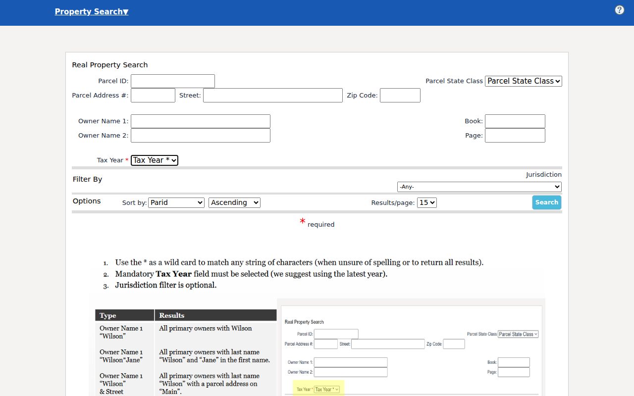
The capture makes the address, street, ZIP, owner, book/page, and tax-year controls visible in one place. It also reinforces why a dated result matters.
Separate Charleston Address Fields
A central Charleston quirk is the split between the property or situs address and the owner's mailing address. Situs means the place where the parcel sits. Mailing address means the place selected for tax correspondence. It may be another home, an office, a post office box, or an address outside Kanawha County. A mailing match can help identify an owner, but it cannot establish who lives in the building being searched.
- Parcel
- A separately identified tract used for tax and map records.
- Situs address
- The street location assigned to the property itself.
- Plat
- A recorded map showing lots, blocks, streets, or subdivision lines.
- Criss-cross directory
- A directory arranged by street or phone number rather than only by surname.
Label both fields in research notes. This small habit prevents one of the most common street-directory errors and makes later deed and map checks far easier.
Note: Charleston tax mail can point to an owner, but the situs field identifies the parcel being studied.
Map Charleston Parcels by Street
The WV Property Viewer works well after IAS supplies an address or parcel. Its E-911 mode accepts street address, city, and state. Parcel-attribute mode can search by county, owner, property address, or full parcel number. Map drawing tools accept a point, rectangle, polygon, and buffer. Results show GIS ID, owner names, and address, with a 1,000-row cap.
The viewer offers parcel and tax-district boundaries, address labels, flood zones, and reference layers. Parcel outlines appear only at closer scale. Address data comes from SAMS, while owner and parcel data comes from IAS, so a mismatch is possible. Save both versions and ask the assessor to resolve the difference. The Kanawha mapping office states that tax maps are based on deeds and surveys for assessment and are not legal surveys.
The state parcel viewer capture shows the map tool used by the Charleston street directory.
Use highlighted polygons to locate adjacent tax records, then confirm any boundary or title issue through recorded documents rather than the screen outline.
Charleston Records Keyed by Address
No one Charleston record is a complete household roll. The most useful sets answer narrower questions and have different access routes. Online tools come first where available, but the city and county counters remain vital when a search fails.
| Address record | Keeper | Street evidence | Access route |
|---|---|---|---|
| Tax parcel | Kanawha Assessor | Owner, situs, mailing, parcel, class, tax year | IAS, office, historic land books |
| GIS parcel | County GIS / WV Viewer | Mapped parcel and adjacent IDs | Free viewers, map-card office copy |
| Deed or plat | Kanawha County Clerk | Parties, title transfer, legal description | Vendor index, record room, Archives |
| Voter file | County voter office / WV SOS | Authorized registration and residence fields | Name/DOB lookup, office inspection, data request |
| Permit or code file | Charleston Development Services | Project address and named parties | Office or city FOIA request |
| Historical directory | KCPL, WV Archives, WVU | Point-in-time name and street clues | Library shelf, archive list, microfilm |
The county clerk is at 409 Virginia Street East and the record-room phone is 304-357-0240. Voter registration uses 415 Quarrier Street and 304-357-0110. Those direct routes are more useful than a broad request when the file type is known.
Follow Charleston Deeds Backward
The Kanawha WV Land Records listing identifies deeds, deeds of trust, liens, releases, plat maps, assignments, agreements, affidavits, cemetery deeds, and other categories. It does not publish an official online cutoff, image fee, or account rule in the inspected material. Use the vendor route as an index lead and the county clerk as custodian.
Begin with the assessor owner and search that person as grantee, the buyer receiving title. Match the parcel through legal description, lot and block, subdivision, or earlier book/page. Read the deed for the grantor, the seller. Search that grantor as the prior grantee and repeat. An old deed may not contain a modern Charleston street number, which is why the plat and legal description matter.
The deed landing page illustrates the document families behind a street-directory title search.
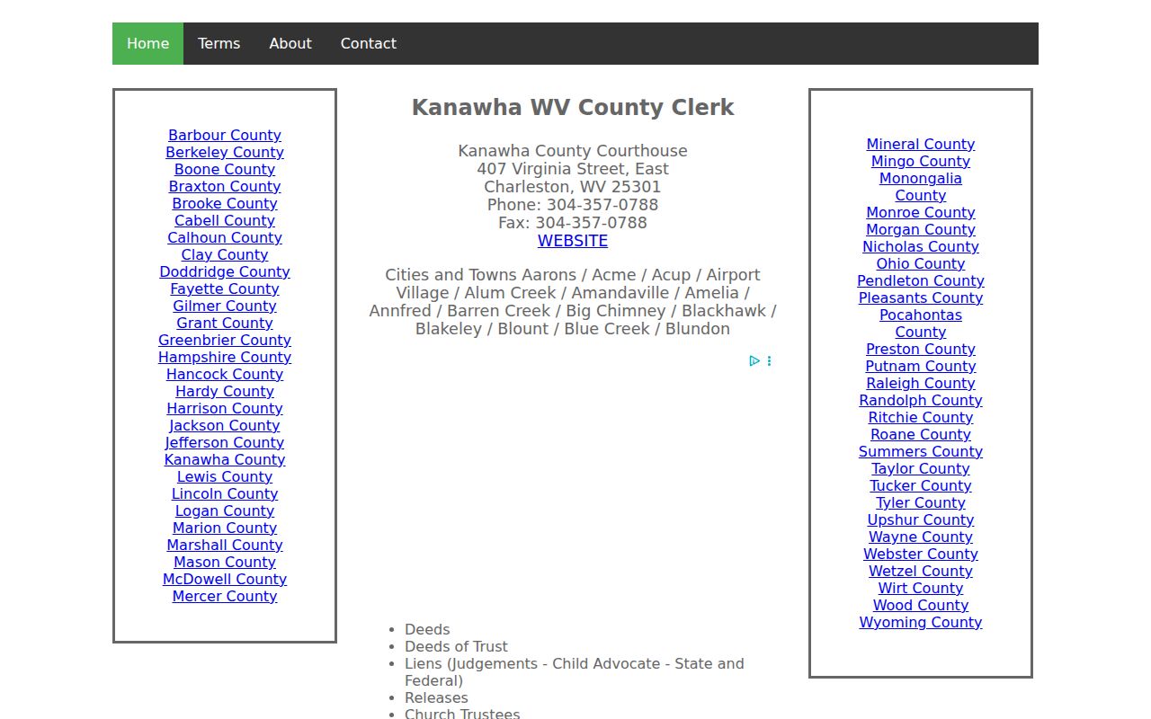
When online images stop, the record room and WV Archives provide the fallback. Archives lists deeds from 1790–1910, a grantor index from 1790–1946, and a grantee index from 1795–1967.
Check Charleston Voter Evidence
The free West Virginia voter lookup requires first name, last name, and date of birth. A match may return status, party, districts, and polling place. It has no street browse field. The public database updates nightly, and a failed match can reflect spelling, timing, status, a name change, or a protected address.
For a street-level file, W. Va. Code §3-2-30 permits inspection of listed active, inactive, rejected, and canceled records during clerk hours. Public fields may include name, residence address, status, registration details, party, and voting history. Phone, email, Social Security, driver's-license, and state-ID numbers are excluded. The clerk may set written selection and format rules. The full state request form supports county, precinct, district, and municipal selections, file formats, and stated use restrictions.
A voter entry is registration evidence, not a census of all Charleston occupants. The Address Confidentiality Program can also replace a qualifying participant's true location with a substitute address.
Request Charleston Address Files
Permits and code files can tie a project to an address even though Charleston has no confirmed public permit-search portal. The Building Commission handles permits, plans, inspections, vacant structures, citations, and dilapidated-structure records at 915 Quarrier Street, Suite 5. A named applicant or contractor is a project party, not proof of residence.
Ask for a defined address, rough date range, permit or inspection type, and preferred copy format. If the ordinary office route is not enough, use the Charleston FOIA form. Its required description box should state the department, record class, address, and dates with care. Code complaint identities may remain confidential, and a notice or complaint is not proof that a resident committed a violation.
Note: Address-specific wording helps Charleston staff locate a file that is not exposed through a public online index.
Bridge Old Charleston Street Names
Charleston has a documented process for naming, renaming, closing, dedicating, and assigning streets, but no official citywide renumbering crosswalk was found. The city's street naming process asks for the old and new name, location, district, tax map, parcel, block range, cross streets, and a map. Council and planning files can therefore prove one change even when no master list exists.
When an old number fails, compare a directory street spelling with subdivision plats, deeds, adjacent cross streets, council journals, and Sanborn maps. Do not assign a date to a renaming without a dated local record. The historical collections themselves are handled more fully in the Charleston city directory material.
West Side planning also supplies geographic context. Its association began in 1996 and describes boundaries from the Elk River to the Kanawha River, west to the Dunbar line and along Route 25 to Sugar Creek. That description aids orientation, but it is not a parcel boundary or member roll.
Limits of Charleston Street Records
A Charleston street directory can identify tax owners, recorded parties, registered voters, project participants, and people printed in an old volume. It cannot name every person who sleeps at an address. Relatives, guests, unregistered voters, and people protected by law may never appear. A stale record may also preserve a former address.
Use address records lawfully. Do not use Charleston street records to stalk, harass, intimidate, or uncover a protected person's true address. Respect the West Virginia Address Confidentiality Program and confirm consequential facts with the custodian.
Commercial neighbor tools often merge old and current data without showing dates or source limits. Official records are narrower, but they identify the keeper and purpose of each fact. For family history, estate work, property curiosity, civic review, or scam checks, a dated record trail is safer than a broad unverified profile.
Note: A parcel map locates tax geography; only recorded title and a proper survey resolve legal ownership and boundary disputes.